Aspiring to inspire past and future pilots
For those of us that were flying ten plus years ago then climbed into a cave until now, VOR’s (Very High-Frequency Omni-Directional Range) were the means of navigation, just a hair below dead reckoning. I was teaching at the beginning of the Garmin 430 and Foreflight days. That’s right, steam gauges were still king. I’m from the day of tuning in the local AM radio station on the NDB (Non-Directional Beacon) for entertainment and even a little navigational assistance. VOR’s were everywhere and the main source of navigation information.
Who would have guessed that merely 10 years later as I’m going through the Sporty’s eFIRC (e Flight Instructors Refresher Clinic), I learn that select VORs are going away and some have already been decommissioned.
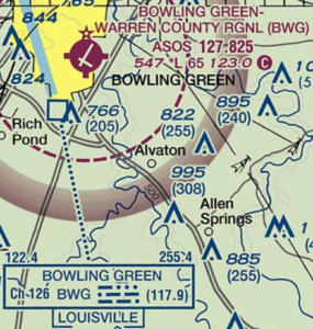
BWG (Bowling Green) and CCT (Central City) VORs were two I used quite often both in my own personal training and when I eventually provided training. Both of these have been decommissioned already however both have DME (Distance Measuring Equipment) still installed on the sites.
It is important to know that not ALL VORs are going away. Why do I point this out? Well because we as CFIs still need to teach this ‘old school’ navigation system. GPS is great, but focusing solely on GPS could lead to an issue for our students down the road.
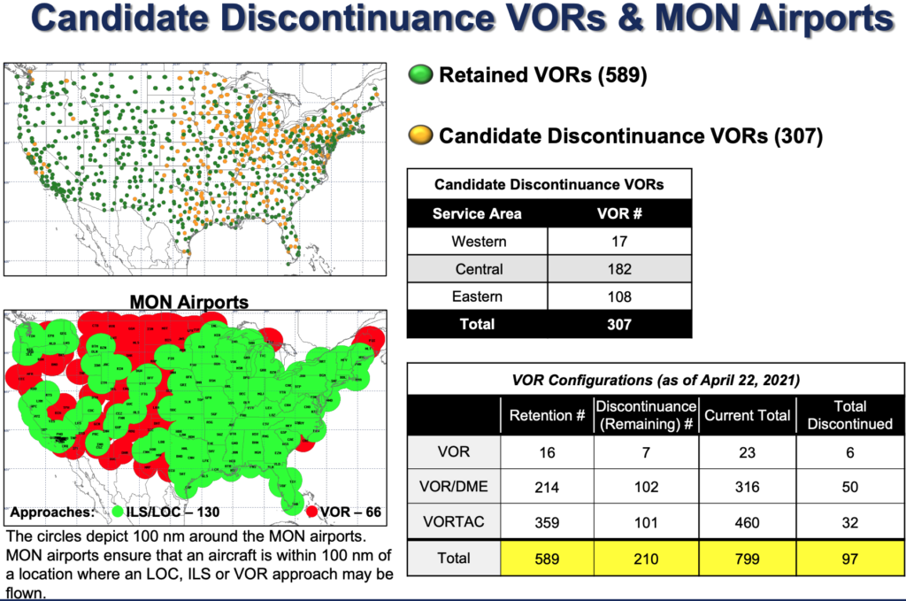
The FAA has a set of conditions that a VOR must meet in order to keep it in operation. If none 0f those conditions are met, the VOR is studied for decommissioning. The overall plan is referred to as the MON (Minimum Operational Network). More information can be found in the Federal Register.
What’s all the fuss about?
Suppose for just a second you are flying along IFR in the soup. You are navigating by GPS and all is well. You are still seventy miles from your destination. All of a sudden GNSS (Global Navigation Satellite System) suffers an outage. Now what? Do you know where the nearest MON airport is? Do you have the approach plates for such an airport? VOR approaches, ILS approaches? Something to think about on your next flight plan.
As a reminder, there are currently thirty-one GNSS satellites in orbit (Up from the original twenty-four us rust pilots started with.) In order to establish your position in two dimensions, three satellites must be in ‘view’ of the receiver. Four or more satellites are required for a three-dimensional position. Your receiver also uses RAIM (Receiver Autonomous Integrity Monitoring) to ensure the satellites are providing accurate information. RAIM requires five satellites for authentication or four satellites and a barometric altimeter. You can check predicted RAIM issues on the FAA’s website.
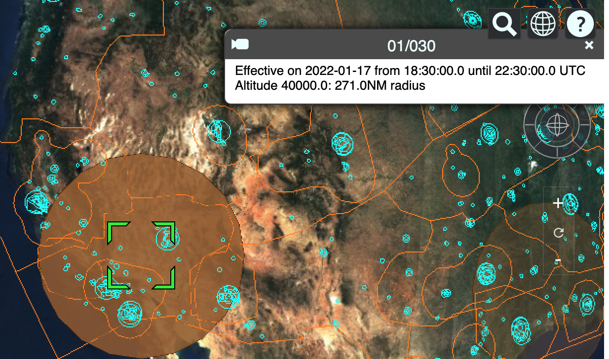
A sample of the RAIM prediction tool
Even without a GNSS failure, your receiver either detects a RAIM issue or doesn’t have enough sources to calculate from, MON airports can become very important.
How do I know?
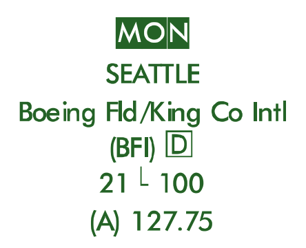

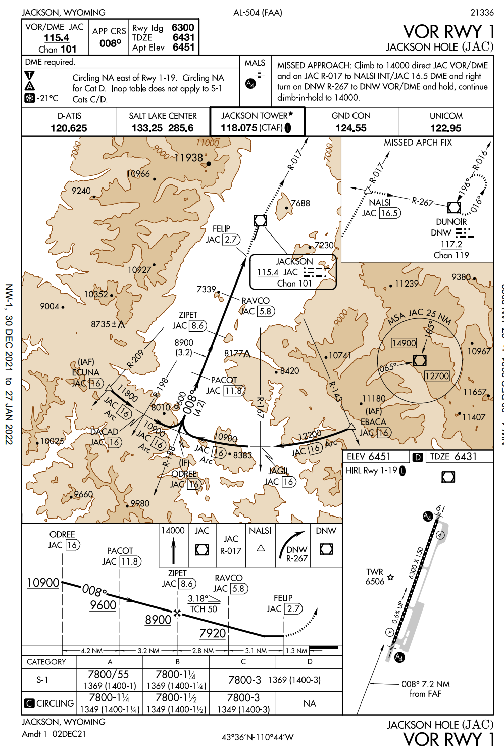
Your favorite VOR has been decommissioned. You are familiar with the area in which you are flying, but you have no idea which airports around you are considered MON. How do you know? Well back in the old days, we’d call that green book the A/FD (Airport Facilities Directory) which is now known as the Chart Supplement. A list of MON airports can be found within. Another source is the IFR Low and High altitude charts. The top image to the right is from the IFR Low Altitude chart while the bottom one is from the IFR High Altitude chart. Each clearly marks the airport as MON with the text in a green reverse font. If you check the Jackson Hole list of approaches, you’ll find the VOR approaches of old listed and available.